

"Avoid Without Sacrificing" – Interactive workshop on smart traffic avoidance at the Mobility Conference...
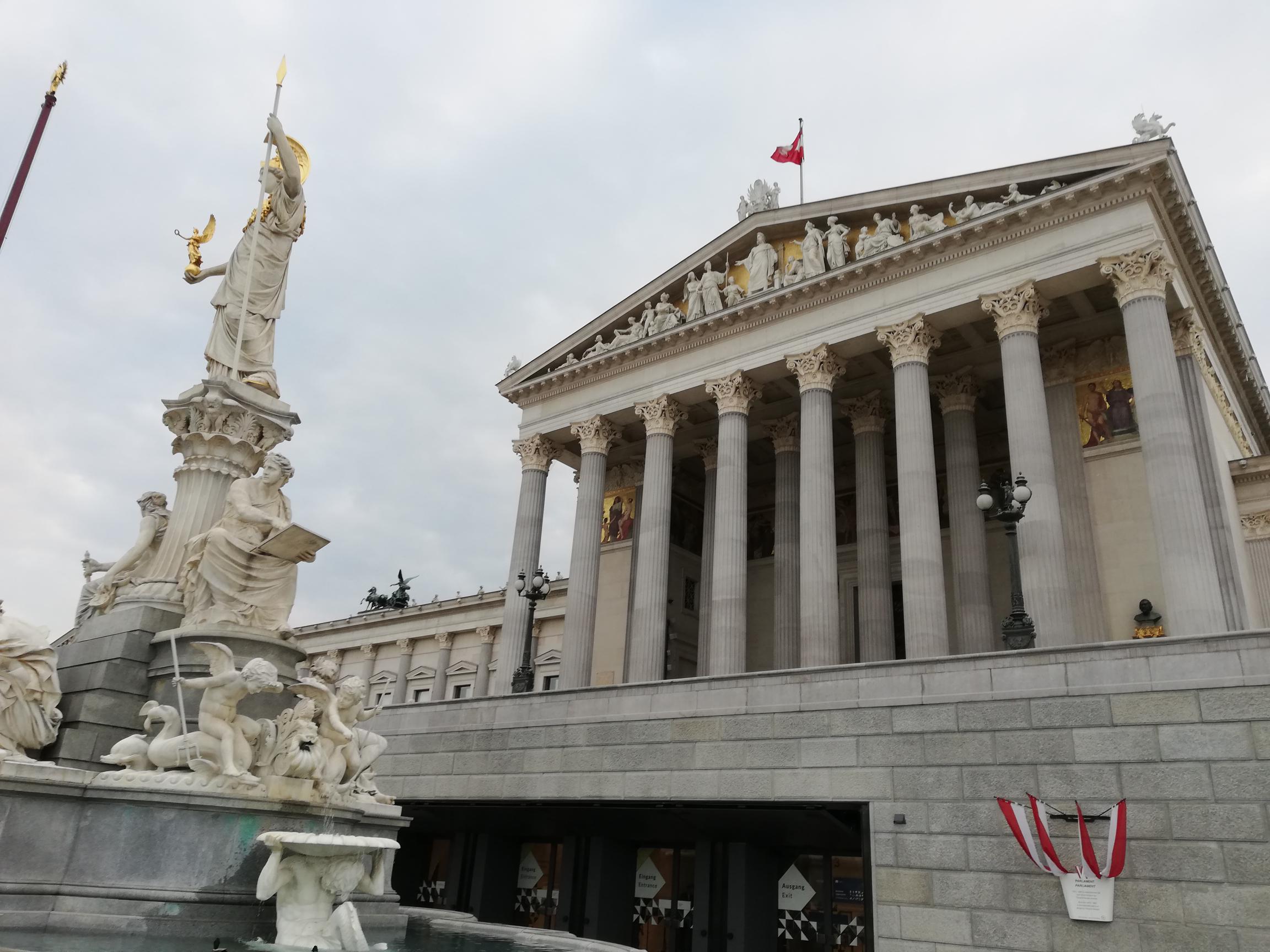
Exchange, further development, and an inclusive highlight at the Parliament as part of the Kura:Div...
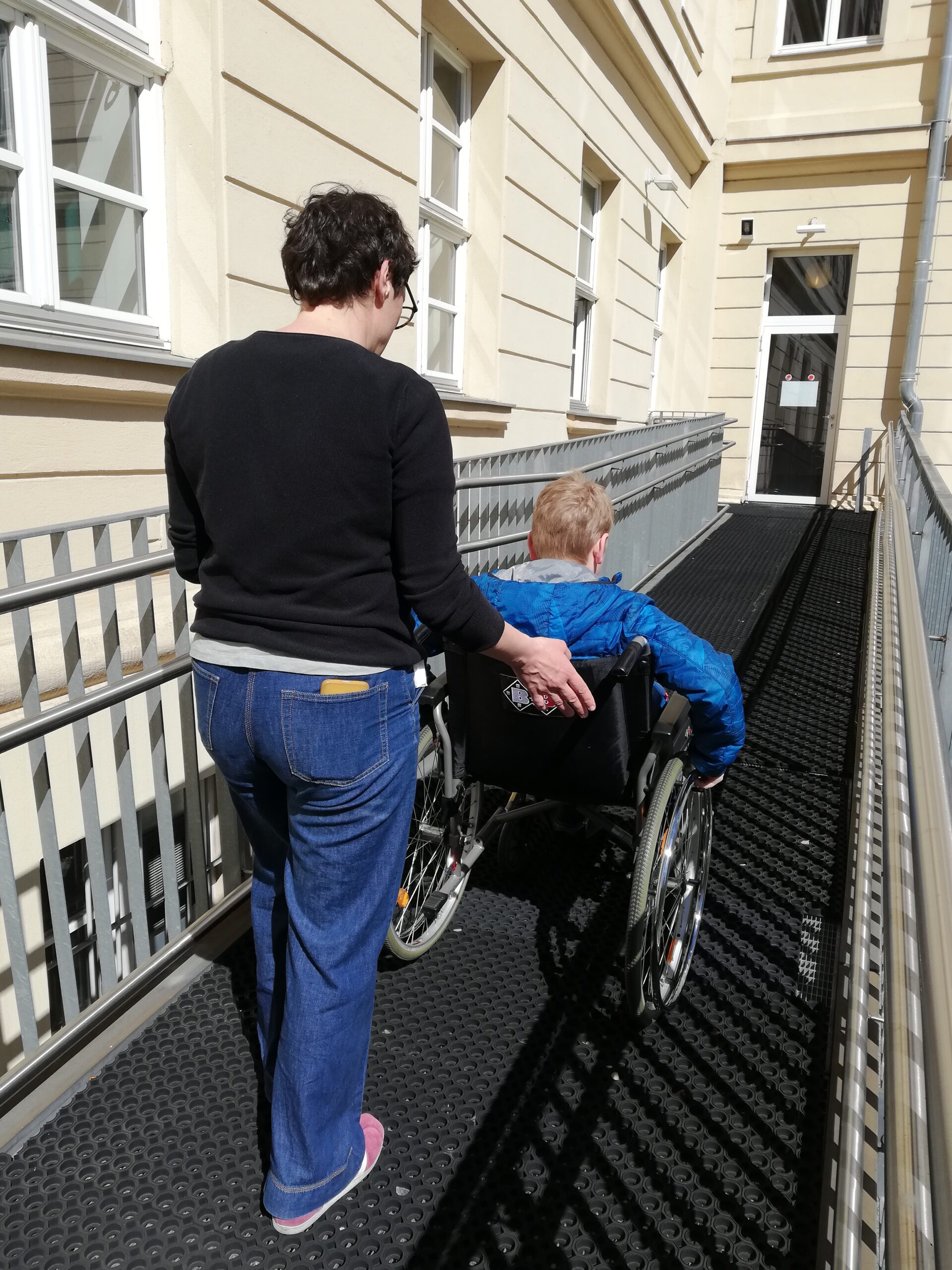
What does accessibility mean in the urban environment? The children are rediscovering their surroundings....
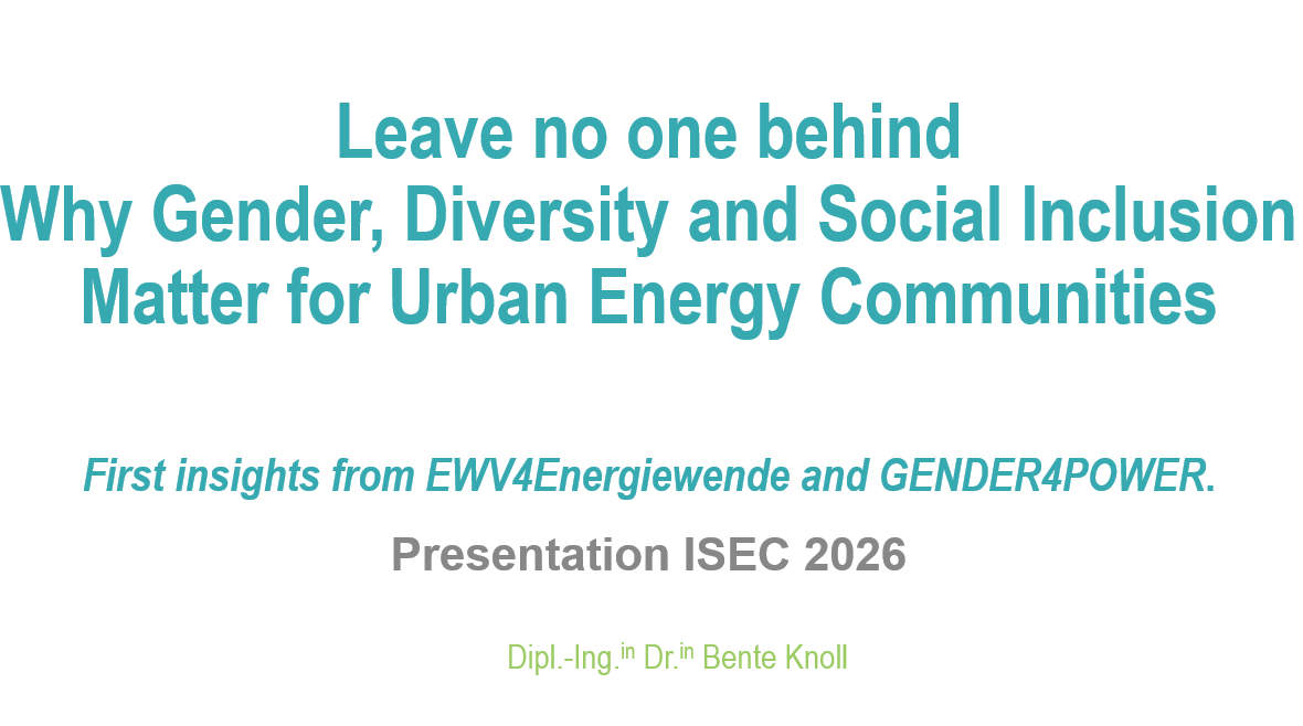
Leave no one behind – Presentation of the energy projects "EW4EnergieWende" and "GENDER4POWER" in Gr...
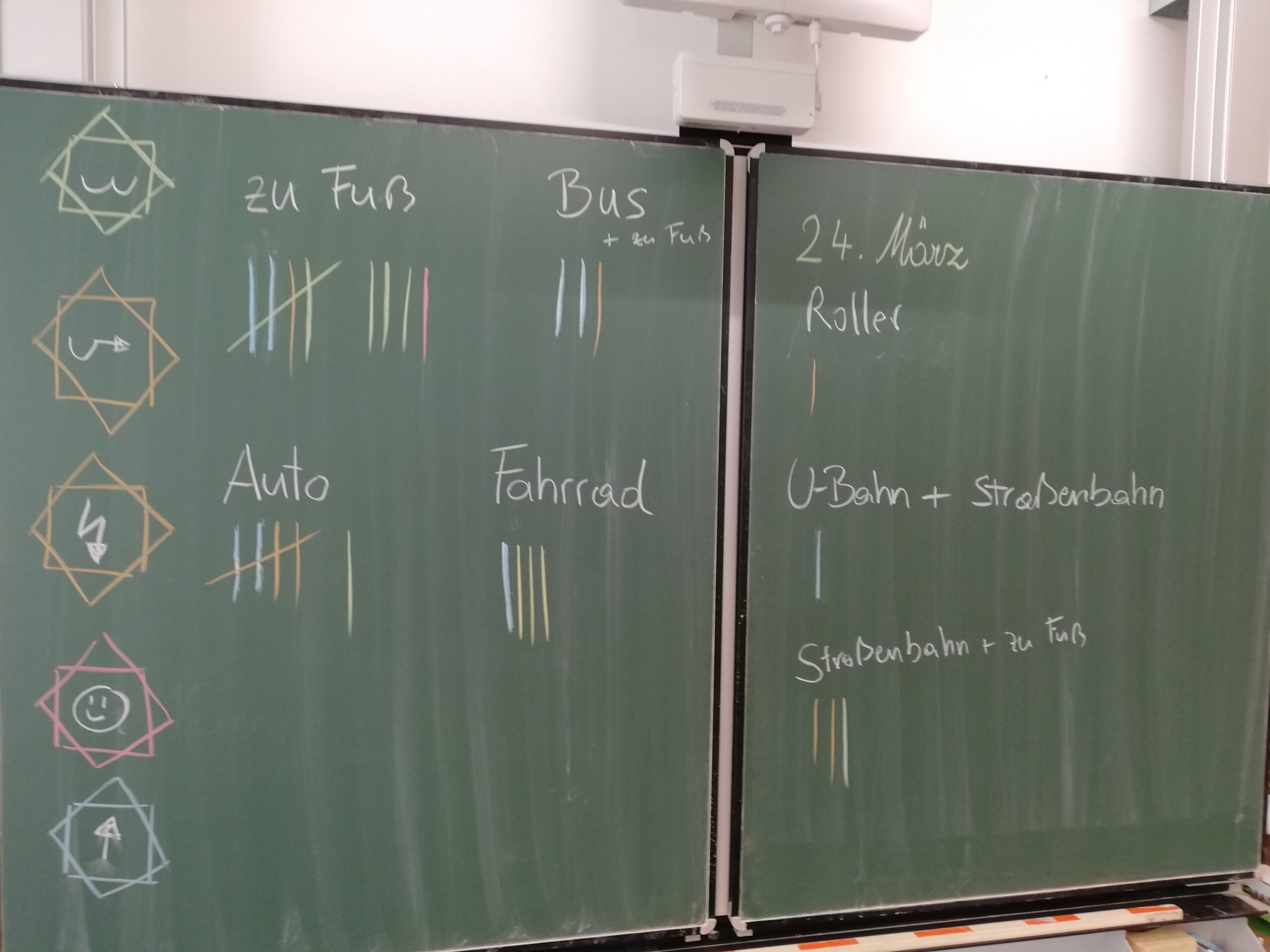
Mini-Cosmos: Streets – What is a street, and who uses it? How do we all get to school?

In this project, students explore the street—both what is visible and what is hidden, above and below...